Maps are very useful in war, more useful than guns or men when there are none.

en.wikipedia.org
Near the end of June, 1861, Hotchkiss signed on as a Confederate teamster to take supplies to the Churchville Cavalry at
Rich Mountain, West Virginia. Hotchkiss offered his services as a mapmaker to
Brig. Gen. Richard B. Garnett, whose Confederate
brigade was operating in western Virginia. Hotchkiss served at
Rich Mountain and created maps for General
Robert E. Lee's planned campaign in the mountains. He took a brief medical leave after being stricken with
typhoid fever, but returned to duty in March 1862 as chief topographical engineer of the
Valley District, reporting to
Maj. Gen. Stonewall Jackson.
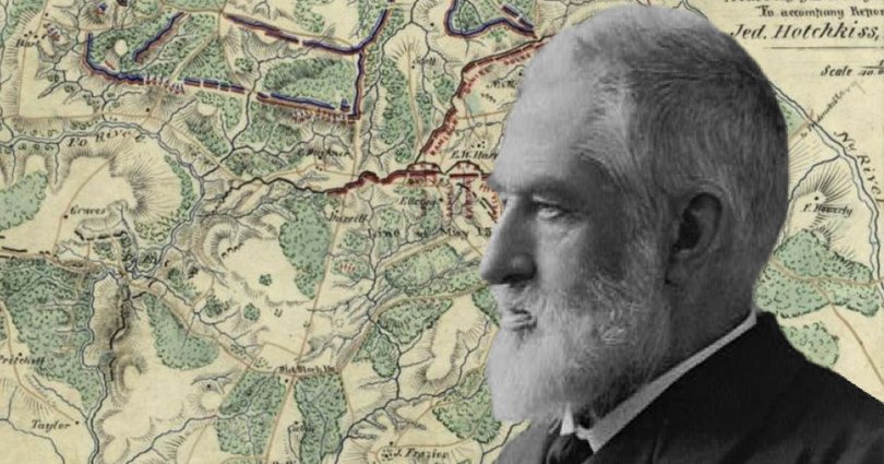
[3] On March 26, 1862, Jackson summoned Hotchkiss to his headquarters and directed him to "make me a map of the
Valley, from
Harper's Ferry to
Lexington, showing all the points of offence and defence [sic] in those places."
The Shenandoah Valley had never been mapped in detail before. Running 150 miles in length and 25 miles wide, it was a daunting task, but Hotchkiss accepted the assignment, and worked on the map for the remainder of the war. In order to accommodate his large scale of 1:80,000, he glued together three portions of tracing linen to form a large single map of 7 feet by 3 feet.
[4]

 www.battlefields.org